Satellite monitoring can be used to monitor for flares with anomalous methane emissions. Whilst several technologies are now available, and further systems and services being launched in the coming years the technology can be broadly classed into two types of activity:
There are advantages and challenges associated with both technologies but both rely upon additional information – such as visible imagery or VIIRS to differentiate flaring from other potential sources of methane, such as intentional venting.
In addition to satellite operators, there are a growing number of service organisations that will process publicly available or privately sourced data and use analytics to give insights to an operator.
How it Works
Advantages
Global coverage provides an overview of changes in flaring – allowing regional trends to be measured.
Publicly accessible data provides an independent view of changes to flaring
Limitations
Multi-spectral imaging is dependent upon daylight and cloud-free cover for the location of interest. In some parts of the world, cloud free days are rare.
Quantification is dependent upon additional information, such as wind speed.
The relatively low resolution of current systems means that individual flares cannot be differentiated by wide area systems. In parts of the world where multiple operators are co-located, flaring cannot be assigned to any specific operator or facility.
Measurements conducted over water, ice or snow are subject to light reflection, which impairs data accuracy. Work is ongoing to develop specialised ‘glint mode’ analytics to provide improved data over water.
Case study
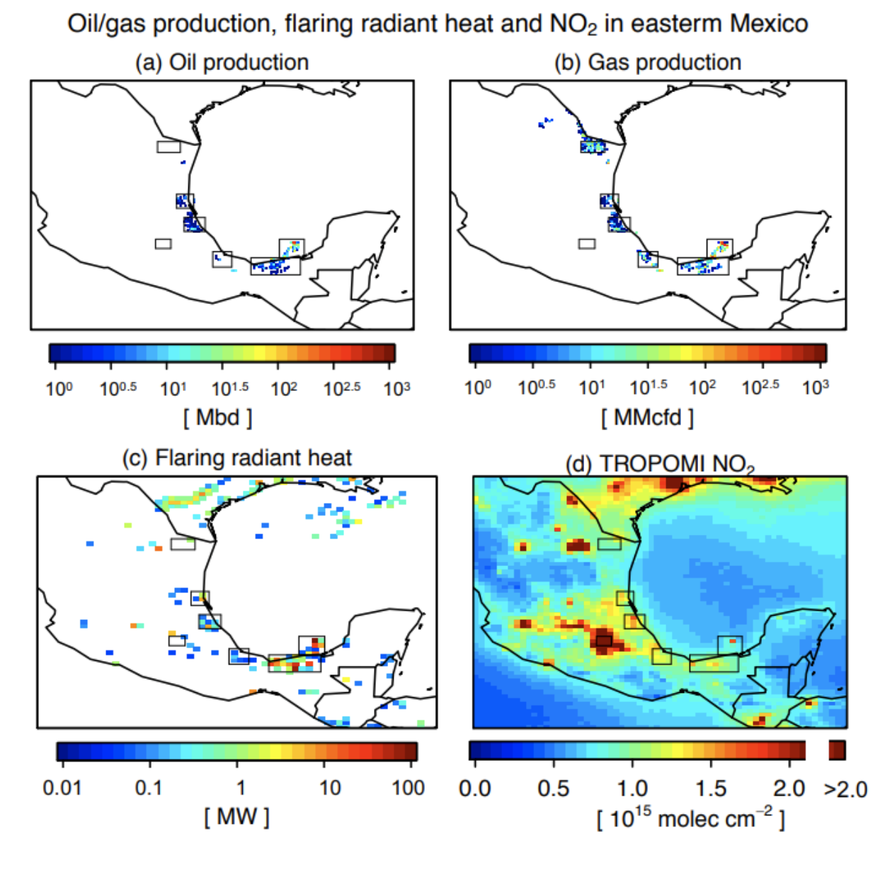
Oil/gas production, flaring radiant heat, and TROPOMI NO2 column mixing ratio in eastern Mexico. (a) Oil production from the Hydrocarbon Information System 540 (https://sih.hidrocarburos.gob.mx/, accessed in June 2020). The unit Mbd is thousand barrels per day. (b) Same as (a) but for gas production. The unit MMcfd is million cubic feet per day. (c) Gas flaring radiant heat from the Visible Infrared Imaging Radiometer Suite (VIIRS) data (Elvidge et al., 2015). (d) Tropospheric column density of NO2 from TROPOMI. All data are averages for May 2018 – December 2019 in eastern Mexico.